Current Weather Outlook
Statewide weather outlook from Florida Division of Emergency Management Meteorology
Friday, May 15, 2026
... Mostly Sunny and Dry Conditions Remain Statewide as High Pressure Settles Overhead... Sensitive to Locally Elevated Wildfire Danger Along the I-10 Corridor this Afternoon... An Isolated Shower or Thunderstorm Possible Across Interior South Florida... Highs in the 80s and 90s... Feels-like Temperatures Reach the Middle 90s in South Florida... Moderate to High Risk for Rip Currents for Statewide Beaches...
Updated at 9:54 AM EDT
Today's Threats:
|
No Threat |
Low Threat |
Medium Threat |
High Threat |
|
Lightning |
Tornado |
Damaging Wind/Hail |
Wildfire |
Excessive Heat |
Flash Flooding |
Fog (Overnight) |
Rip Currents |
|
Interior South FL |
|
|
Locally I-10 Corridor Statewide |
|
|
|
East Coast West Coast & Panhandle Northwest FL & Nature Coast |
![]()
Weather Summary for the Next 24 Hours:
Area of high pressure continues to build into the Southeast U.S., nosing into portions of North and Central Florida today. Drier air will filter into much of North and Central Florida this afternoon, with relative humidities falling to critical thresholds (20-30%) along the I-10 corridor. This will encourage at least sensitive wildfire conditions with locally elevated conditions possible in areas that saw the least amount of rainfall earlier this week.
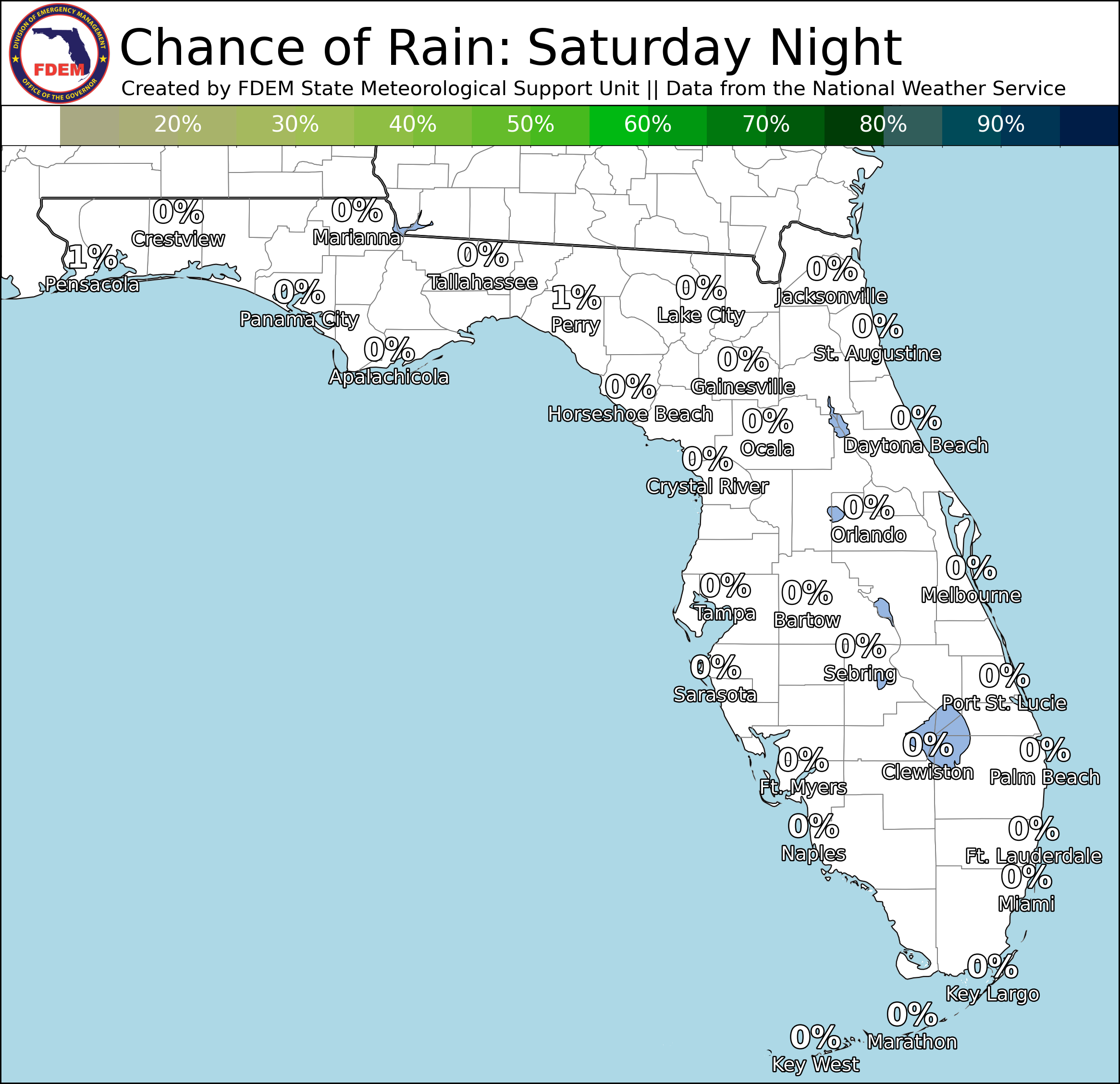
Lingering moisture across interior South Florida will allow for a few isolated showers and thunderstorms to develop along the sea breezes this afternoon (20-30% chance of rain). Although there is no organized risk for flash flooding, a locally heavy downpour or two cannot be ruled out.

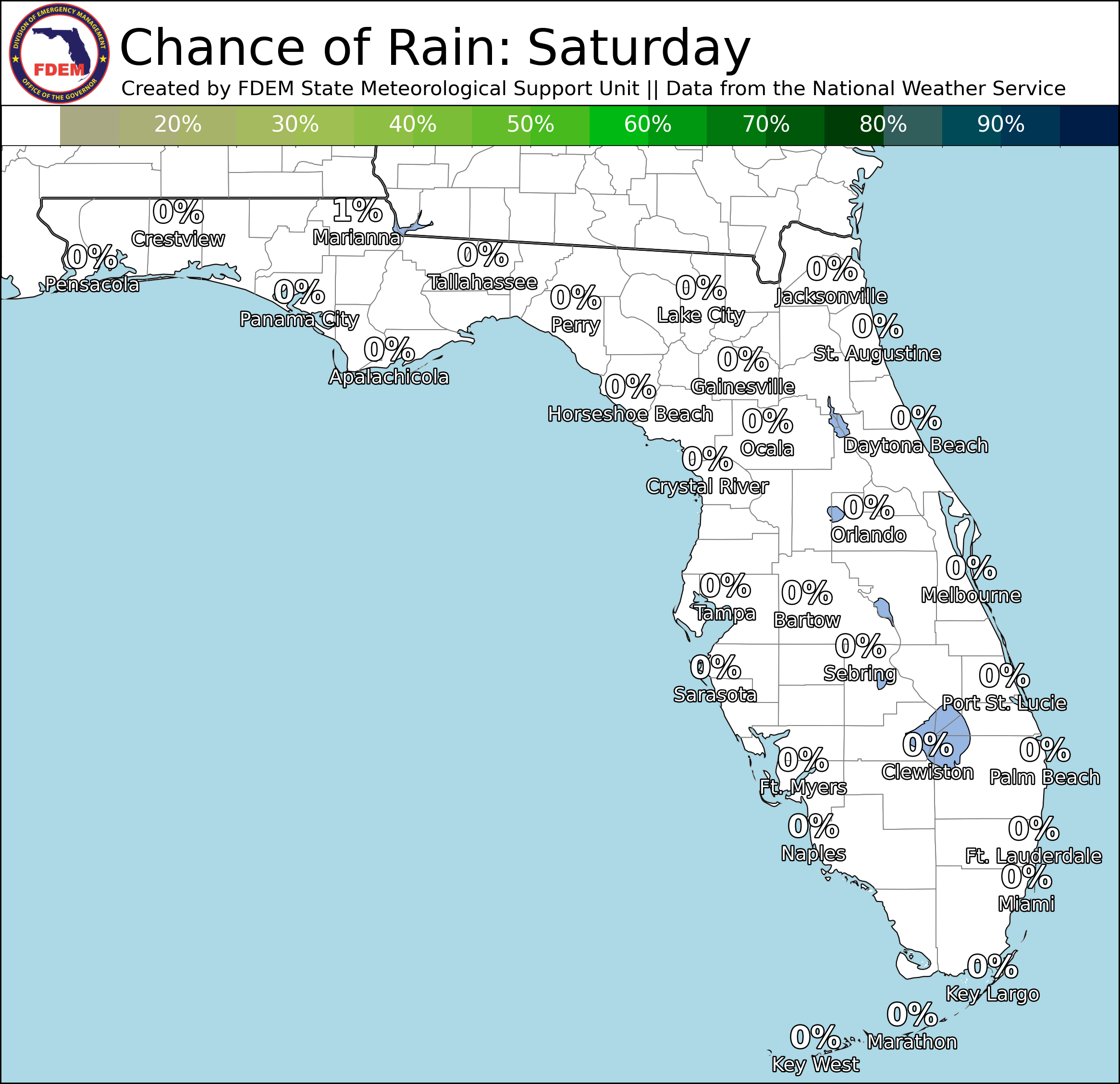
High temperatures will reach the middle 80s to lower 90s throughout much of the state today. A few middle 90s cannot be ruled out in Southwest Florida. An isolated shower may linger across interior South Florida this evening before dissipating after sunset (15-20% chance of rain). Otherwise, clear and dry conditions will prevail overnight. Lows will dip into the middle 50s to lower 60s across much of North Florida with 70s in Central and South Florida. The Southeast Metro and Keys will remain in the upper 70s to lower 80s.

![]()

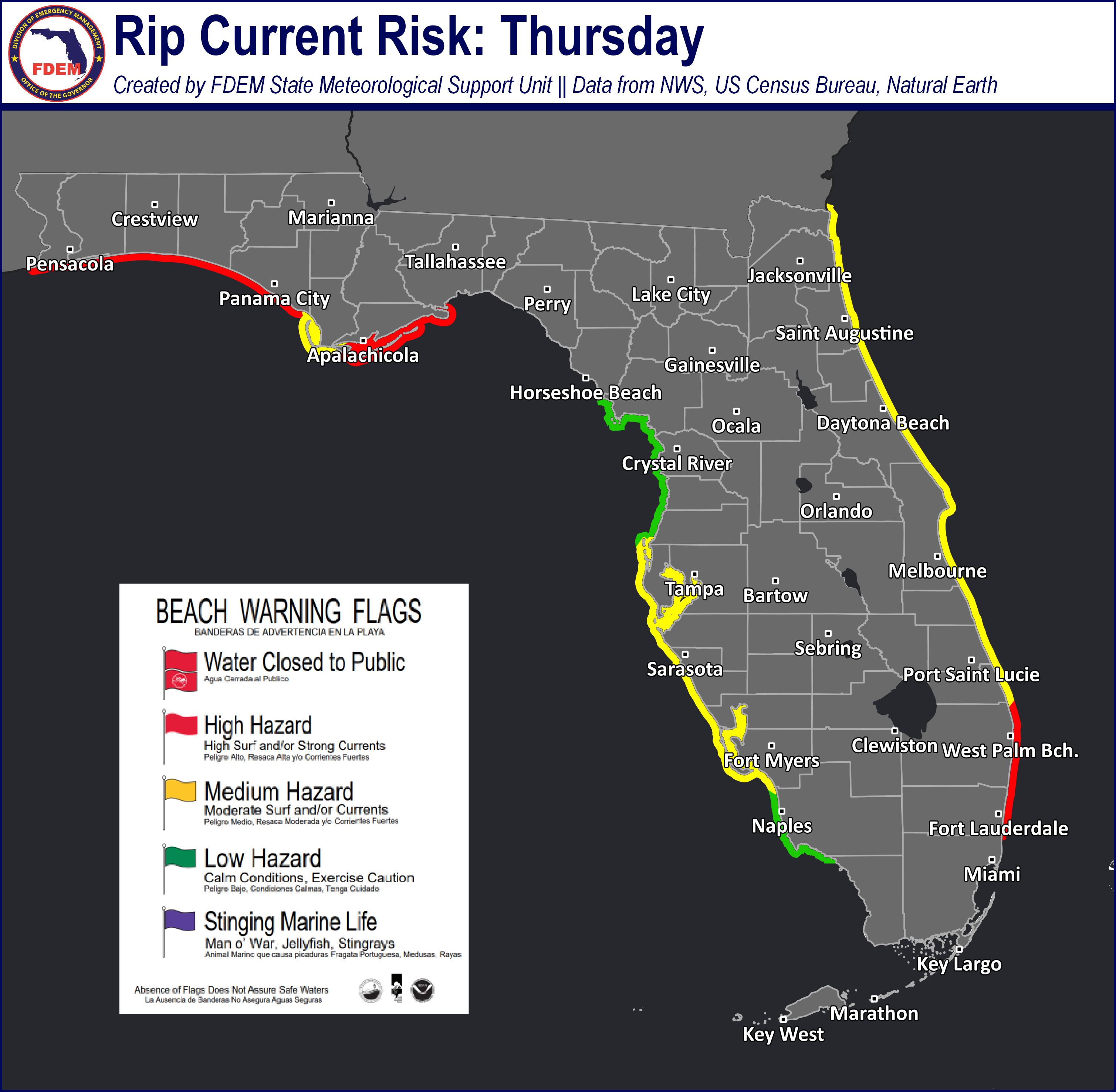
Rip Currents: Onshore winds and elevated surf will keep a high risk for rip currents outlooked for most East Coast beaches today, with a moderate risk across Southeast Florida beaches. A moderate risk is also expected for West Coast and Panhandle beaches. A low risk is expected for Nature Coast and Northwest Florida beaches. For the latest Rip Current Outlook, visit www.weather.gov/beach.
Marine Hazards: Seas will remain elevated today along the East Coast, with waves reaching 2-4’. Waves will also remain near 2-3’ for West Coast beaches. Panhandle beaches can expect surf near 1’.
Red Tide was observed at background concentrations in Escambia, Santa Rosa, Bay, and Sarasota counties. It was not observed elsewhere across the state (valid 5/8/26).
Coastal Flooding: There is no risk for coastal flooding today.
![]()
Fire Weather: High pressure anchored across the Southeast U.S. will help to filter critically low relative humidities (20-30%) throughout North Florida this afternoon. Despite winds remaining generally calm this afternoon, the ongoing drought will encourage at least sensitive wildfire conditions with the potential for locally elevated conditions throughout the Panhandle. KBDI values remain well above 500 (critical drying) along the Nature Coast and West-Central Florida which will also encourage the locally sensitive wildfire danger despite RH expected to stay above critical thresholds. Isolated thunderstorms across interior South Florida this afternoon may be accompanied by lightning and gusty/erratic winds which can spark new wildfires or reignite existing ones. According to the Florida Forest Service, there are 44 active wildfires across the state burning approximately 17,646 acres.
Drought (5/12/26): Some categorical improvements were made on this week’s Drought Monitor update across the Panhandle where plentiful rainfall fell. Rainfall totals measured 4 to 6 inches across the northern Panhandle, with localized amounts upwards of 6 to 8 inches or more. As a result, the extreme drought across northern Escambia, Okaloosa, and Santa Rosa counties has been downgraded to a severe drought (level 2 of 4). The exceptional drought across much of Jackson County has also been reduced to an extreme drought (level 3 of 4) due to this heavy rainfall. Despite rainfall adding up to 1 to 2 inches across the Big Bend and Suwannee River Valley, the severity of the ongoing drought resulted in no changes to the exceptional drought (level 4 of 4). Throughout the Peninsula, rainfall was mostly confined to the I-95 corridor and interior South Florida, with amounts generally between 1-2 inches. This was not enough for any improvements in the drought throughout the Peninsula, with areas of Southeast Florida actually seeing expanding moderate (level 1 of 4) to extreme drought (level 3 of 4). The larger drought picture was otherwise untouched. As a reminder, the cutoff for rainfall on this week’s update was Tuesday (5/12) at 8 AM EDT, thus the heavy rainfall that fell on Tuesday and Wednesday of this week will be taken into account on next week’s update. This rainfall will likely help with drought conditions across the state, though significant improvements are not expected given just how long this drought has been in place and how severe the long-term rainfall deficits are. 99% of Florida remains in at least a moderate drought, with 24% of the state (eastern Panhandle to Suwannee Valley) in an exceptional drought.

The Keetch-Byram Drought Index average for Florida is 435 (+2) on a scale from 0 (very wet) to 800 (very dry). There are 30 out of 67 Florida counties that have an average KBDI above 500 (drought/increased fire danger).

![]()
Flash Flooding: There is no organized risk for flash flooding today. However, isolated showers and thunderstorms across interior South Florida may be accompanied by a few locally heavy downpours. Rainfall amounts will remain generally below 1”, though a few localized areas may receive upwards of 2”.

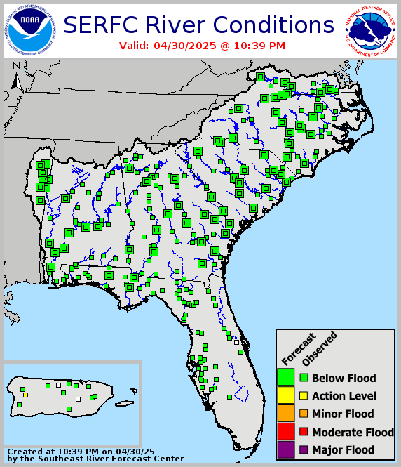
Riverine Flooding: There are no riverine concerns across the state. For more information, visit the River Forecast Center.
Lake Okeechobee’s average elevation is 11.41 feet, which is within the operational band and is 1.90 feet below normal for this time of year.