Current Weather Outlook
Statewide weather outlook from Florida Division of Emergency Management MeteorologyTuesday, May 21, 2024
...Drier Conditions Return Statewide as High Pressure Develops Along the Eastern Seaboard...Onshore Winds to Bring Isolated Showers Inland Along the East Coast Late This Morning and into the Afternoon...Sea Breeze Collision During the Peak Heating Hours of the Day to Bring Isoalted to Scattered Showers and Thunderstorms Throughout the Peninsula...Isolated Strong to Severe Thunderstorm Cannot Be Ruled Out...Locally Heavy Downpours May Lead to Localized Flash Flooding and Ponding of Water Across Urban and Low-Lying/Poor Drainage Areas...Heat Index Values in the Middle 90s Across South Florida and the Keys...Minor Riverine Flooding Continues Along Portions of Panhandle and Big Bend Following Last Weeks Active Weather Pattern...
Updated at 9:48 AM EDT
Today's Threats:
| No Threat | Low Threat | Medium Threat | High Threat |
| Lightning | Tornado | Damaging Wind | Hail | Flash Flooding | Excessive Heat | Wildfire | Rip Currents |
|
South Florida Central Florida Iso. NE FL |
Locally Int. Peninsula & South Florida |
Locally South Florida & Keys |
Locally South Florida & Keys |
Iso. South Florida & Keys |
Int. Central Florida |
Panhandle East Coast West Coast |
![]()
Weather Summary for the Next 24 Hours:
High pressure returns along the U.S. Eastern Seaboard which will help to keep conditions mostly dry across North Florida throughout the day. Mostly dry conditions can be expected during the morning and early afternoon hours across the Peninsula, with the help of high pressure. Onshore winds will help to push showers onshore later this morning and into the early afternoon due to a low pressure system just east of the Florida Peninsula. Later this afternoon and evening, the sea breeze boundaries along the Gulf and Atlantic coasts will push inland and collide with one another. Isolated to scattered showers and thunderstorms can be expected to develop during the peak heating hours of the day across the interior Peninsula, from the I-75 corridor and through South Florida (40-55% chance of rain). While there is no organized risk for severe weather, an isolated strong to severe thunderstorm or two cannot be ruled out during the peak heating hours of the day. Any strong to severe thunderstorm that develops will be capable of producing frequent lightning, gusty winds (40-50 mph), small hail (dime size) and heavy downpours. While mostly dry conditions are expected west of the I-75 corridor, a stray shower or two may be possible along the coastal Big Bend this afternoon; however, drier conditions may prevent activity from developing.

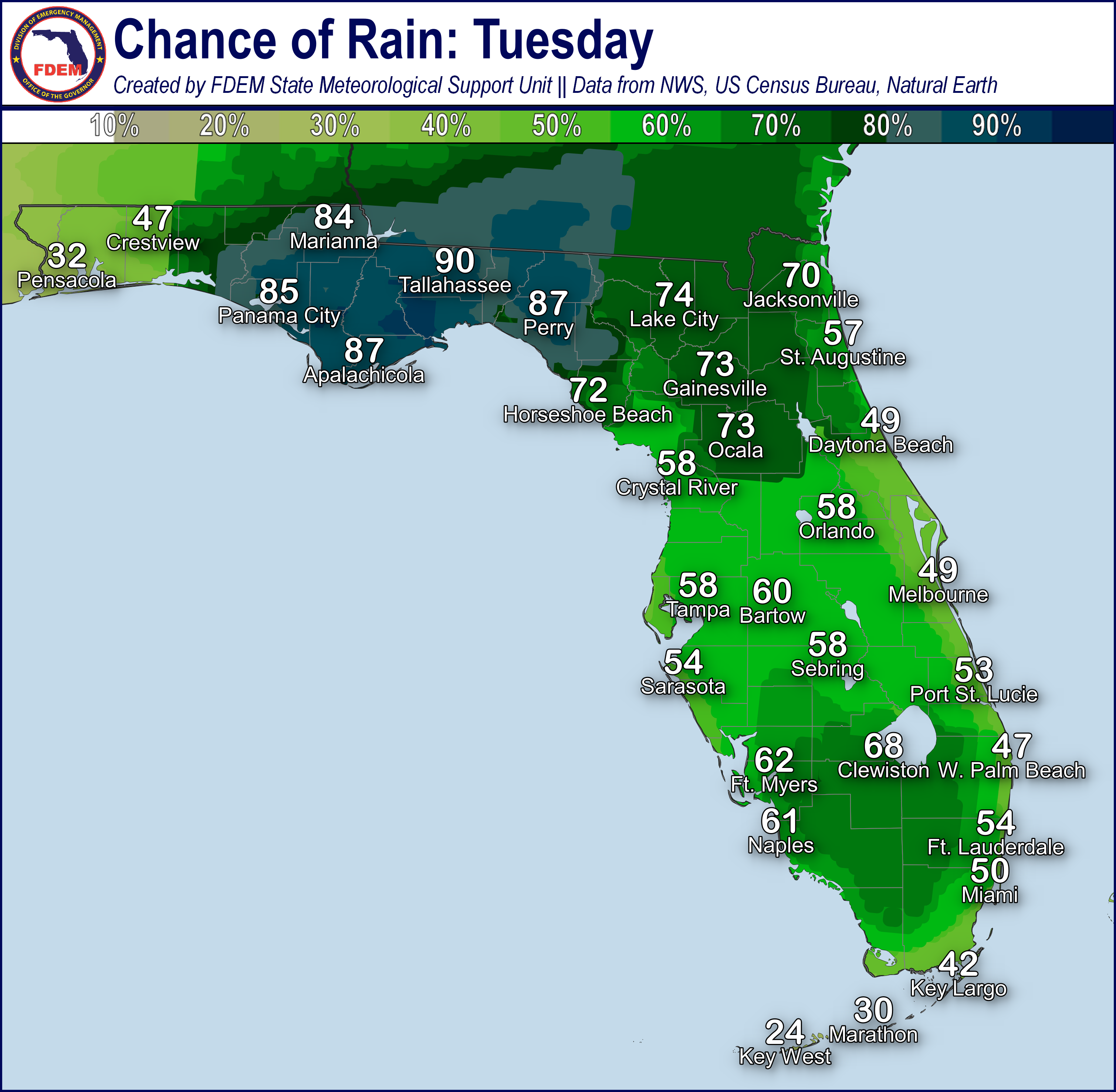
Shower and thunderstorm activity will continue through the evening hours as the sea breeze moves back towards the adjacent coastal waters. These showers and thunderstorms will follow the sea breeze as they drift back towards the coastline late in the evening before dissipating (20-40% chance of rain). There is a chance for some lingering showers along the coastlines overnight, especially across the southernmost Peninsula regions and over the Florida Keys.
High temperatures will warm up into the middle to upper 80s and low 90s this afternoon, with portions of Southwest Florida approaching the middle 90s. Heat index values, or feels-like temperatures, will remain in the middle 90s by the early to middle afternoon hours across South Florida and the Keys. Low temperatures will remain in the middle to upper 60s across North Florida, low to middle 70s across Central and South Florida, and near 80-degrees across Florida Keys.

![]()

Rip Currents: Onshore winds and a developing ocean swell will create a moderate risk for rip currents along numerous East Coast beaches. A moderate to high risk for rip currents continues for several Panhandle beaches due to onshore winds. West Coast beaches have returned to a low risk for rip currents. For the latest Rip Current Outlook, visit www.weather.gov/beach.
Marine Hazards: An ocean swell developing just offshore from the Southeast U.S. will create wave heights of 3-5’ along the Florida East Coast, with the largest waves along Northeast Florida beaches. All other beaches across the state can expect wave heights near 1-2’.
Red Tide has not been observed at or above background levels over the past week.
Coastal Flooding: There is no risk for coastal flooding today.
![]()

Tropical cyclone formation is not expected during the next 7 days in the Atlantic Basin.
The National Hurricane Center has begun issuing regular Tropical Weather Outlooks for the 2024 hurricane season as of May 15. These outlooks show areas of possible tropical cyclone development in the next 48 hours and next 7 days. Outlooks are issued every 6 hours at 8am, 2pm, 8pm, and 2am eastern time, or as conditions warrant. The Atlantic Hurricane Season officials begins June 1.
For the latest on the tropics, please visit the National Hurricane Center (NHC) at www.hurricanes.gov.
![]()
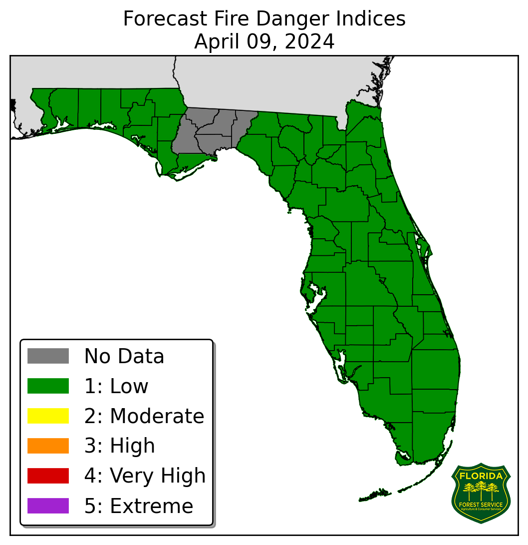
Fire Weather: Drier conditions can be expected throughout the morning and into the afternoon nearly statewide as high pressure moves over the U.S. Eastern Seaboard. Onshore winds will continue to bring moisture inland across the East Florida, keeping relative humidity values well above critical thresholds this afternoon. Portions of interior West-Central and Southwest Florida will see relative humidity values near critical thresholds this afternoon (upper 30%). The sea breeze collision across the interior Peninsula this afternoon and evening will give way to isolated to scattered showers and thunderstorms. Thunderstorms may be capable of producing gusty and erratic winds as well as frequent lightning. Ongoing warm temperatures and drought conditions along portions of the central and southern Peninsula will continue to create sensitive wildfire conditions. According to the Florida Forest Service, there are 44 active wildfires across the state burning approximately 2605 acres.

Drought: While heavy rainfall was observed across portions of the state over the past week, Central and South Florida continues to see very limited rainfall an above normal temperatures (2-4-degress above normal), leading to additional expansions in drought conditions on this week’s update as fire danger is high, and dryness continues to compound. Moderate Drought conditions now span from the West Coast to the East Coast from a line north of Fort Myers to north of West Palm Beach and northward to a line from Sarasota to Melbourne. Abnormally dry (emerging drought) conditions have expanded further along the I-4 corridor and south of Lake Okeechobee to Fort Lauderdale. Continued above normal temperatures and below normal precipitation over the next 6-10 days will likely continue to exacerbate drought conditions.
The Keetch-Byram Drought Index average for Florida is 307 (+7) on a scale from 0 (very wet) to 800 (very dry). There are 12 Florida counties (Broward, Charlotte, Collier, DeSoto, Glades, Hardee, Hendry, Highlands, Manatee, Miami-Dade, Palm Beach, and Sarasota) with an average KBDI over 500 (drought/increased fire danger).
![]()
Flash Flooding: There is no organized risk for flash flooding today. Showers and thunderstorms developing along the sea breeze boundaries, especially over South Florida and the upper Keys, will be capable of producing heavy downpours within activity. Rainfall totals of 1-2” can be expected with any shower and thunderstorm activity that develops along the sea breeze, but locally higher totals upwards of 3-4” cannot be ruled out across South Florida and the Keys. Locally heavy downpours may lead to instances of localized flash flooding and ponding of water at times. Recent heavy rainfall over the Florida Keys may exacerbate any flooding potential within shower and thunderstorm activity today. Any slow-moving or training showers and thunderstorms over the same areas may also lead to localized flash flooding across urban and low-lying/poor drainage areas.

Riverine Flooding: Rainfall continues to deposit from heavy rainfall over the last few days allowing for water levels along rivers, creeks and waterways to rise along the Panhandle and Big Bend. River Flood Warnings are in effect for the Choctawhatchee River near Bruce-Ebro, Ochlockonee River near Concord and near Havana, St. Marks River near Newport, and Santa Fe River near Three Rivers Estates as minor flooding is ongoing or forecast. Several other waterways along the Panhandle, Big Bend and Suwannee Valley are within or forecast to rise to Action Stage (bank-full) over the next few days. Drier conditions across the region over the next few days should allow for rivers, creeks and waterways to level out as water deposits into the basins. As water moves through the river basins, there is potential for flooding further down later this week and into next week for the Suwannee River basin. For more details, please visit the River Forecast Center.
Lake Okeechobee’s average elevation is 13.47 feet, which is within the operational band and 0.25 feet above normal for this time of year.
