Current Weather Outlook
Statewide weather outlook from Florida Division of Emergency Management MeteorologyWednesday, May 1, 2024
...Dense Fog Advisories Extend Across Panhandle Through Mid-Morning Hours Due to Foggy Conditions Reducing Visibility...Partly Cloudy to Mostly Sunny Skies Developing Throughout the Day...Lingering Moisture and Collision of Sea Breeze Boundaries to Create Isolated to Widely Scattered Showers and Thunderstorms from Big Bend and Throughout the Peninsula...Strong Thunderstorms Capable of Producing Lightning, Gusty Winds and Heavy Downpours...Locally Heavy Downpours May Lead to Localized Instances of Ponding of Water Across Urban and Low-Lying/Poor Drainage Areas...Patchy to Widespread Fog Possible Overnight and Early Thursday Morning Across North Florida and Portions of Interior Central and South Florida...Moderate to High Risk for Rip Currents Continues Along Panhandle and East Coast Beaches...Minor Riverine Flooding for Santa Fe and Suwannee Rivers...
Updated at 9:18 AM EDT
Today's Threats:
| No Threat | Low Threat | Medium Threat | High Threat |
| Lightning | Damaging Wind/Hail | Tornado | Flash Flooding | Fog (Overnight) | Wildfire | River Flooding | Rip Currents |
|
Big Bend & South Florida Iso. Northeast Florida & Peninsula |
Iso. South Florida | Iso. Southwest Florida & Southeast Metro |
Panhandle & Big Bend Northeast Florida & Int. Central Florida Iso. Interior South Florida |
Locally Iso. West-Central & Interior Peninsula |
Suwannee River & Santa Fe River |
E. Panhandle & East Coast W. Panhandle & Southeast Florida West Coast |
![]()
Weather Summary for the Next 24 Hours:
Dense Fog Advisories are in effect through the mid-morning hours along the Florida Panhandle and western Big Bend due to foggy conditions reducing visibility to ¼ of a mile or less at times. Clearing foggy conditions will give way to partly cloudy to mostly sunny conditions through the afternoon as high pressure develops over the Carolina’s. Throughout the day, both the Atlantic and Gulf sea breeze boundaries will push inland and collide with one another, allowing for isolated to widely scattered showers and thunderstorms to develop from the Big Bend and throughout the Peninsula (20-40% chance of rain). While there is no organized risk for severe weather, a few strong thunderstorms capable of producing lightning, gusty winds and heavy downpours cannot be ruled during the peak heating hours of the afternoon and evening. Locally heavy downpours may also lead to localized instances of ponding of water across urban and low-lying/poor drainage areas throughout South Florida, including the Southeast Metropolitan area. High temperatures will reach the middle to upper 80s and low 90s statewide, with coastal areas seeing slightly cooler temperatures due to the sea breeze.

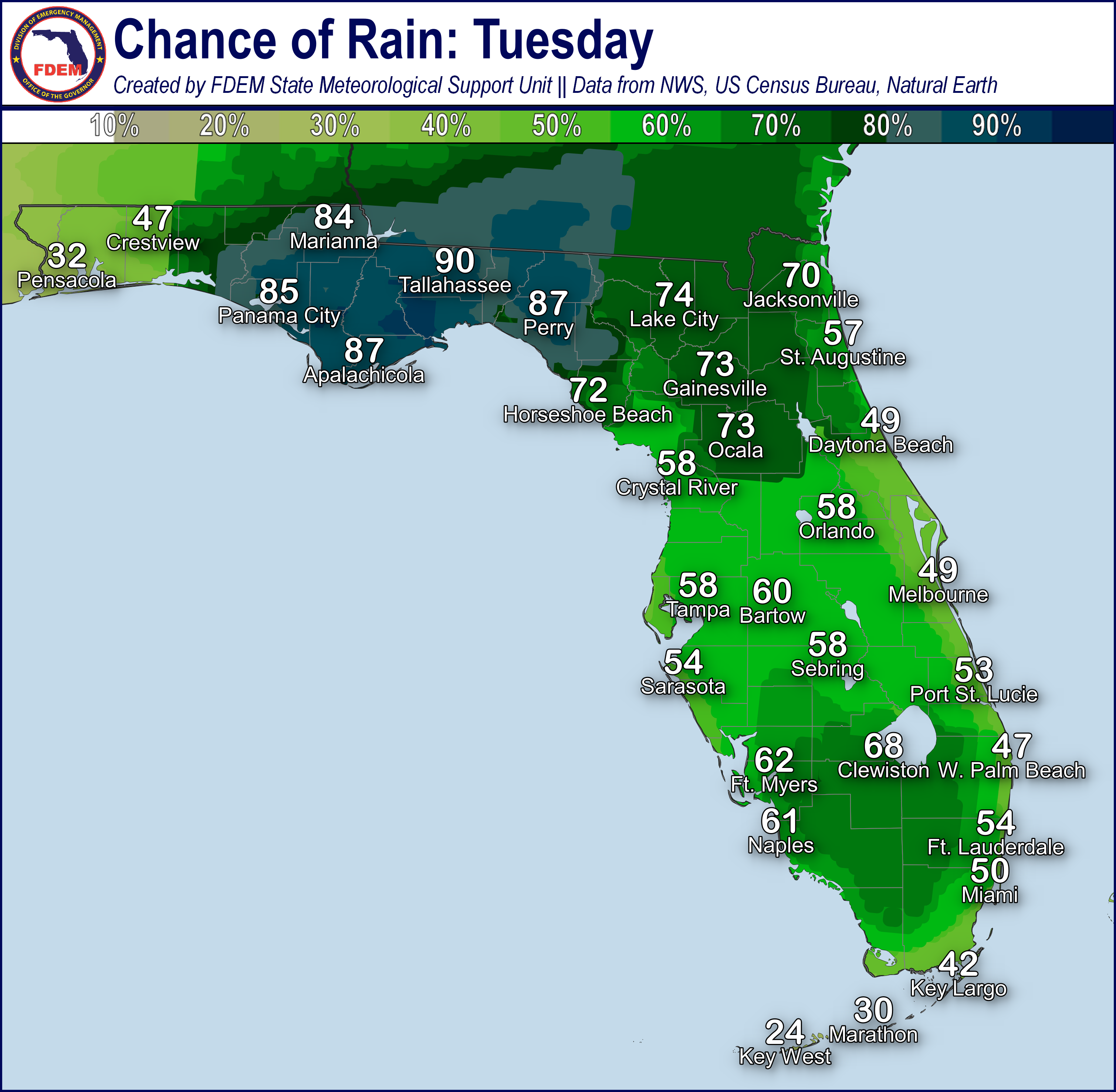
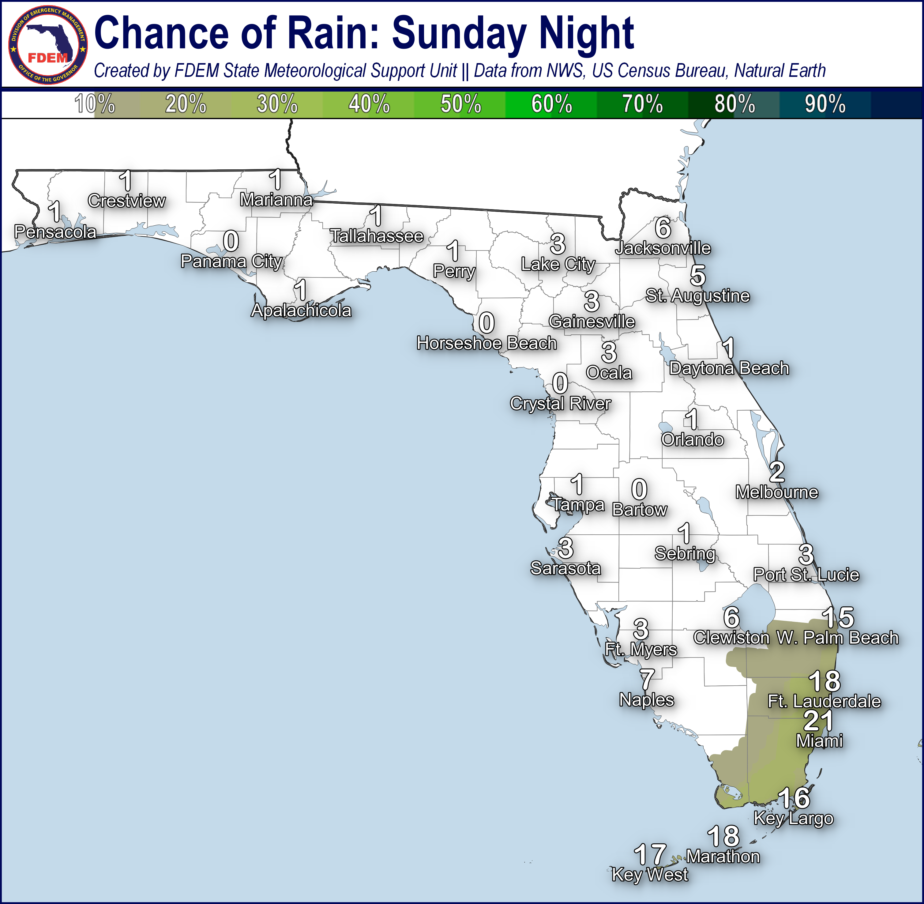
Shower and thunderstorm activity will linger through the evening hours before slowly dissipating overnight (15-30% chance of rain). As shower and thunderstorm activity weakens and dissipates it will move towards the coastlines and the adjacent waters, which may allow for lingering activity overnight. Isolated showers and a few rumbles of thunder cannot be ruled out over the waters and near the coastlines overnight. Lingering moisture and calm winds overnight and early Thursday morning will give way to areas of patchy to locally widespread fog developing throughout North Florida and along interior portions of Central and South Florida. Low temperatures overnight will remain in the middle to upper 60s across North and Central Florida and low to middle 70s across South Florida and the Keys. Warmer low temperatures across South Florida and the Keys will give little relief from daytime highs.

![]()

Rip Currents: A high risk for rip currents can be expected for several Panhandle and East Coast beaches due to persistent onshore winds and lingering ocean swells. A moderate risk for rip currents can be expected for the far western Panhandle and Southeast Florida beaches. A low risk for rip currents continues for West Coast beaches. For the latest Rip Current Outlook, visit www.weather.gov/beach.
Marine Hazards:A lingering ocean swell along East-Central Florida will bring wave heights of 3-4’ through the morning hours. The rest of the East Coast will see wave heights of 2-3’ due to persistent onshore winds along the coastlines. Weakening wave heights of 1-2’ can be expected for Panhandle and West Coast beaches due to calming seas.
Red Tide has not been observed at or above background levels over the past week.
Coastal Flooding: There is no risk of coastal flooding today.
![]()
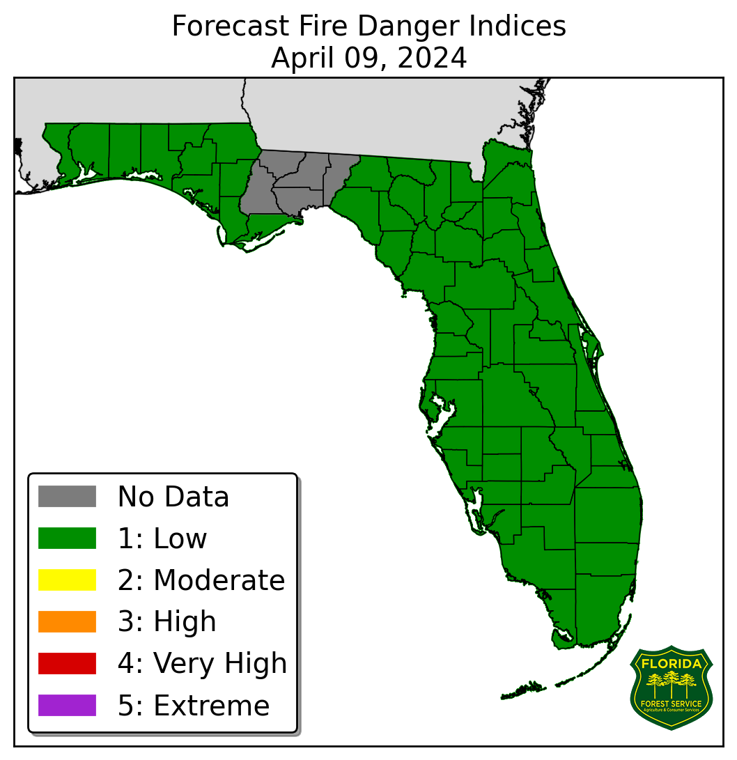
Fire Weather: Dense Fog has developed this morning along the Florida Panhandle reducing visibility to ¼ of a mile or less at times. Foggy conditions may further reduce visibility where there are any ongoing wildfires. Dry air remains settled within areas along the I-75 corridor and West-Central Florida, which will allow for relative humidity values to fall near critical thresholds this afternoon (upper 30%). Light winds can be expected throughout much of the day before the sea breeze and gulf breeze move inland and collide with one another creating wind gusts of 10-15 mph at times. With the collision of the sea breeze boundaries, isolated to widely scattered showers and possible thunderstorms can be expected this evening throughout the Peninsula. Any thunderstorm activity that develops will be capable of producing lightning, gusty winds and heavy downpours. Lightning and gusty winds from thunderstorms, especially over emerging drought areas across the Peninsula, may result in the ignition or further spreading of wildfires. Another round of patchy fog to locally widespread can be expected overnight and early Thursday morning throughout much of North Florida and into interior portions of the Peninsula. According to the Florida Forest Service, there are 50 active wildfires across the state burning approximately 2870 acres.

Drought: High pressure has yielded dry conditions and above normal temperatures nearly statewide over the last week, leading to deteriorating soil moisture and streamflow conditions. Abnormally dry (emerging drought) conditions have expanded along portions of the Central and Southern Peninsula on this week’s drought monitor update and now stretch from the coast to the coast south of I-4 and north of I-75, surrounding and north of Lake Okeechobee. 60-day rainfall deficits have reached 4-6” below normal along eastern portions of Central and South Florida, east and northeast of Lake Okeechobee, with isolated pockets of 6-8” below normal. North and northwest of Lake Okeechobee to the West Coast, 60-day rainfall deficits have reached 2-4” below normal. Little to no rainfall expected across the region over the next week may exacerbate drought conditions.
The Keetch-Byram Drought Index average for Florida is 328 (+8) on a scale from 0 (very wet) to 800 (very dry). There are three Florida counties (Indian River, Martin and St. Lucie) with an average KBDI over 500 (drought/increased fire danger).
![]()
Flash Flooding: There is no organized risk for flash flooding today. Shower and thunderstorm activity develop later this afternoon and evening will bring locally heavy downpours at times, especially along the sea breeze boundaries. Rainfall totals are forecast to remain below 1” along the Big Bend and South Florida, but locally higher totals could reach upwards of 1-2” across portions of the interior Peninsula and South Florida with heavier rainfall. Localized ponding of water cannot be ruled out with heavier downpours this afternoon and evening across urban and low-lying/poor drainage areas.

Riverine Flooding: River Flood Warnings remain in effect along portions of the Suwannee River following heavy rainfall from the early April severe weather event. Minor riverine flooding continues for the Suwannee River at Rock Bluff and Manatee Springs as water levels are forecast to fall below flood stage by the middle to latter portions of this week. Minor riverine flooding is ongoing for Santa Fe River at Hildreth as water levels are forecast to fall below flood stage by midweek. The Santa Fe River at Three Rivers Estates has fallen below moderate flood stage but remains within minor flood stage and is forecast to remain there into next week. There are no additions riverine concerns at this time. For more details, please visit the River Forecast Center.
Lake Okeechobee’s average elevation is 14.19 feet, which is within the operational band and 0.56 feet above normal for this time of year.
